Best Paved Walking Paths in Orange County
Looking for paved walking paths in Orange County? From scenic coastal routes to neighborhood greenways, there are plenty of places to walk without navigating rocky hiking trails. This guide covers paved and mostly paved routes, along with distances, surfaces, parking and what to expect along the way.
A paved route can be more comfortable for families with strollers and anyone who prefers a smoother surface. Conditions, slopes and accessibility vary by trail, so check the official trail information when planning your visit.
Orange County has coastal paths, park loops and neighborhood trails to explore. From beachside routes to hidden urban gyms, here are the places to go to take a stroll.

Quick Guide to Orange County Paved Walking Paths
Choose a route based on the surface and scenery you prefer. Distances are approximate, and some parks have multiple trail options. Paved does not automatically mean level or wheelchair accessible.
| Walking path | Surface | Why visit |
|---|---|---|
| Huntington Beach Bike Path | Paved, shared use | Ocean views and a long coastal route |
| Crystal Cove Bluff Top Trail | Paved | Coastal overlooks |
| Orange County Great Park | Paved and mixed-surface routes | Open space and family amenities |
| Jeffrey Open Space Trail | Paved | Landscaped neighborhood greenway |
| Salt Creek Trail | Paved segments and trail connections | South County scenery |
| Anaheim Coves Trail | Paved | Easy neighborhood walk |
| The Tracks at Brea | Paved bike path; gravel pedestrian path | Urban greenway |
| San Clemente Beach Trail | Compacted dirt and sand, not fully paved | Beachfront alternative |
Choosing a Path for Strollers, Wheelchairs or Bikes
For a smoother walking surface, start with a designated paved route such as Jeffrey Open Space Trail, Anaheim Coves or Crystal Cove's bluff-top path. Coastal paths offer views but may include slopes, shared bicycle traffic or changing conditions. For wheelchair access, check the trail operator's current accessibility information rather than assuming every paved segment is accessible. Watch for signs distinguishing pedestrian and bicycle lanes.
Huntington Beach Bike Path
What else is more classic Southern California vibes than the iconic Huntington Beach? The beach is mild, beautiful and known as Surf City for its excellent waves. So a walk along the coast on this paved path is a must!
As you walk you will pass many fire pits, volleyball courts, basketball courts, and pristine sandy beaches. Huntington Beach is great to hang out for the whole family all day after your walk.
Details:
- Length: 8 miles
- Trail End Points: This trail extends from the south where the Santa Ana River meets the Ocean at PCH (SR1) and extends north all the way to Warner and Pacific Coast Highway.
- Fees: To park at one of the large lots for Huntington Beach City Beach, Bolsa Chica State Beach or Huntington State Beach you must pay a fee. There are free parking spots in the public lots at Warner and PCH.
Crystal Cove Walking Trail
The paved, accessible bluff top trail at Crystal Cove extends from Little Treasure Cove near Pelican Point to the Moro Cave overlook at the Reef Point area. The trail is approximately 3 miles long and sits on the bluffs overlooking Crystal Cove State Beach with panoramic ocean views and overlook points at either end to take in the scenery.
Crystal Cove is a Marine Protected Area with some of the cleanest, most natural beaches in Orange County. There are restrooms located within the state park along the trail.
Details:
- Length: Approximately 3 miles; check the park trail map for the route you plan to walk.
- Trail End Points: Little Treasure Cove to the North and Moro Cave overlook to the south
- Parking: State park parking may require payment; check Crystal Cove State Park for current details.
Orange County Great Park
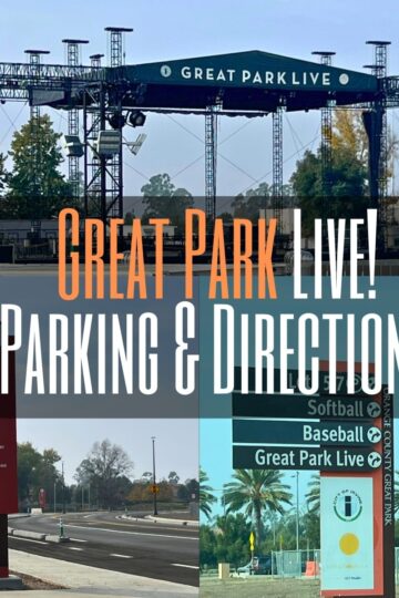
The Orange County Great Park includes plenty of paved multiuse trails plus additional decomposed granite pedestrian trails. The Great Park Trails connect the surrounding neighborhoods to this local community hub where visitors can find numerous amenities including sports fields, restrooms, playgrounds, and more. Surrounded by plenty of natural landscaping, a stroll at the Great Park is just the right getaway to relax and enjoy a walk in the fresh air.
Details:
- Length: Varies by paved path and loop selected.
- Trail End Points: Magnet (north of Great Park Blvd) to Irvine Blvd
- Parking: Check posted parking rules.
Jeffrey Open Space Trail
This trail running through the Irvine Ranch area is actually split into three different panels. The first is an urban one where you can check out the gorgeous homes, cute shops, and open space. The next segment picks up at the Walnut Trail which parallels a rail track. Finally the third section goes past a couple trail connections to end at a pedestrian bridge spanning I-405.
Although Jeffrey Open Space Trail may not be the most secluded path, it has won numerous awards for its concept and design. From the well manicured landscape to how the designers incorporated a series of intaglio panels in the concrete bed of the trail; you will definitely enjoy this walk.
Details:
- Length: Approximately 4 miles, depending on the section walked.
- Trail End Points: Pick up points are where Jeffrey Rd. and Portola Pkwy. meet; finish at University Trail and Juanita Moe Trail at I-405
- Parking: Check posted parking rules.
Salt Creek Trail
This walking path is more of a plan-your-adventure trek versus a straight shot. There are multiple side trails and options to choose from as you walk your way through the two neighborhoods of Laguna Niguel and Dana Point.
The Salt Creek Trail has lovely views of the ocean as you make your way on the bluff. From there you make your way to Chapparosa Community Park with its playground, volleyball courts, and restrooms. If you are still feeling up to extend your walk you can opt to continue on the Aliso Creek Riding and Hiking Trail which connects in Laguna Niguel Regional Park.
Details:
- Length: Route length varies with the connections and segments chosen.
- Trail End Points: Begin this trail at Laguna Niguel Regional Park on Alicia Pkwy and finish at Salt Creek Beach Park in Dana Point
- Parking: Parking rules vary by trailhead; check posted signs and park information.
Anaheim Coves Trails
This trail in Anaheim is a nice and easy one. You will walk along the Santa Ana River where it becomes a lake on a stroller friendly paved path. There is even some shade!
The Anaheim Coves Trails is clean and family friendly within the neighborhoods of Anaheim. It is a nice local escape for anyone in the area.
Details:
- Length: 3 miles
- Trail End Points: Start at Pyrenees Ave and Majorca Street. Finish by S Phoenix Club Dr. and E Ball Rd.
- Parking: Check posted parking rules.
The Tracks at Brea
This route has a paved bicycle path alongside a separate gravel walking path in the small city of Brea. Although this portion is just 4 miles, The Tracks at Brea are part of a quite larger 66 miles of trails and greenways in Orange County under the OC Loop network.
On one end there is Arovista Park with picnic spots, play areas, and restrooms. Along the trail you can stop for a bite to eat, to shop, and enjoy the lovely residential neighborhood.
Details:
- Length: 4 miles
- Trail End Points: The end points are Arovista Park and Valencia Avenue at Nasa Street.
- Parking: Check posted parking rules.
For a comfortable walk, check posted trail conditions and shared-use rules before setting out.
- Always remember when going on a walk to bring water in order to stay hydrated. Southern California is notorious in dehydrating it’s residents.
- Other things you may want to bring along could include a good sunscreen to protect your skin, a shade hat, and bug spray depending on the time of year.
I hope to see you outside walking very soon!
Happy adventures!


Scenic Mostly Unpaved Alternative
Note: This is a scenic mostly unpaved alternative, included for readers who are comfortable with a compacted surface rather than continuous pavement.
San Clemente Beach Trail (Unpaved Alternative)
This trail is quite unique in that it shares it’s space with an active Amtrak line with service between Los Angeles and San Diego. Add in the gorgeous views along the sandy shore and you have a great place for a stroll.
This trail is not a fully paved route. Its compacted dirt and sand surface can be uneven, particularly after weather or shoreline work, so it is best treated as a scenic alternative rather than a reliably smooth paved path.
San Clemente Beach Trail boasts of flower covered cliffs, an impressive bridge, and a pier to explore. You can easily make it a day outing and visit the numerous picnic spots, restaurants, and shops located by the Pier Bowl.
Details:
- Length: 2.3 miles
- Trail End Points: You can start the trail at the San Clemente/North Beach Metrolink Station and finish up at San Clemente State Beach
- Parking: Check posted parking rules.
More Walking Paths and Park Loops in Orange County
These additional parks and greenways offer walking opportunities, but surfaces vary. Some have compacted dirt or gravel rather than continuous pavement. Check the managing agency's map for paved sections, accessibility and current access conditions.
North Orange County
Carbon Canyon Regional Park: 4442 Carbon Canyon Road, Brea, CA 92823
Central Park La Palma: 7821 Walker St, La Palma, CA 90623
Clark Regional Park: 8800 Rosecrans Ave., Buena Park, CA 90621
Craig Regional Park: 3300 State College Blvd., Fullerton, CA 92835
Eisenhower Park: 2864 N Tustin St, Orange, CA 92865
Electric Avenue Greenbelt: 800-840 Electric Ave, Seal Beach, CA 90740
Garden Grove Park: 9301 Westminster Blvd., Garden Grove, CA 92844
Guadalupe Park: 381 S Walnut St, La Habra, CA 90631
Hart Park: 701 S Glassell St, Orange, CA 92866
La Bonita Park: 1440 W Whittier Blvd, La Habra, CA 90631
Liberty Park: 13900 Monroe St, Westminster, CA 92683
Mackay Park: 8732 Walker St, Cypress, CA 90630 (packed dirt)
Oak Knoll Park: 9600 Graham St, Cypress, CA 90630
Old Reservoir Park: La Habra, CA 90631
Silverado Trail: Start at Turtle Park 6525 Thelma Ave, Buena Park, CA 90620, Extends all the way to El Rancho Verde Park
Smith-Murphy Park: 5290 Cameron Dr, Buena Park, CA 90621
Stanton Central Park: 10660 Western Ave, Stanton, CA 90680 (paved and packed dirt)
Tri-City Regional Park: 2301 Kraemer Blvd., Placentia, CA 92870
Twila Reid Park: 3100 W Orange Ave, Anaheim, CA 92804
Vista Del Valle Park: 1600 S Idaho St, La Habra, CA 90631
Wildcatter's Park: 3301 E Santa Fe Rd, Brea, CA 92821
William Peak Park: 7225 El Dorado Dr, Buena Park, CA 90620
Yorba Regional Park: 7600 E. La Palma, Anaheim, CA 92807
Central Orange County
All Newport Beach Walking Trails: Link to Map and Descriptions
Cedar Grove Park: 11385 Pioneer Rd, Tustin, CA 92782
Carl Thornton Park: 1801 W Segerstrom Ave, Santa Ana, CA 92704
Centennial Regional Park: 3000 W Edinger Ave, Santa Ana, CA 92704
Central Park East: 18000 Goldenwest St, Huntington Beach, CA 92647
Central Park West: 6741 Central Park Dr, Huntington Beach, CA 92648
Estancia Park: 1900, Adams Ave, Costa Mesa, CA 92626
Green Valley Park: Fountain Valley, CA
Lion's Park: 570 W 18th St, Costa Mesa, CA 92627
Mason Regional Park: 18712 University Drive, Irvine, CA 92612
Mile Square Regional Park: 16801 Euclid St., Fountain Valley, CA 92708
Pioneer Road Park: 10250 Pioneer Rd, Tustin, CA 92782
TeWinkle Park: 970 Arlington Dr, Costa Mesa, CA 92626
South Orange County
Central Park RSM: 30842 La Miranda, Rancho Santa Margarita, CA 92688
Concourse Park: 18931 Saddleback Ranch Rd, Trabuco Canyon, CA 92679
Creekside Park: 25743 Stonehill Dr, Dana Point, CA 92629
Glenbrook Park: Aliso Viejo, 92656
Grand Park: 6101 City Lights Dr, Aliso Viejo, CA 92656
Heritage Park: 34400 Old Golden Lantern, Dana Point, CA 92629
Hillview Park: 28000 Wolverine Way, Aliso Viejo, CA 92656
Laguna Niguel Regional Park: 28241 La Paz Road, Laguna Niguel, CA 92677
Lake Mission Viejo: Start at 22760 Olympiad Rd, Mission Viejo, CA 92692 and loop around the lake
Lantern Bay Park: 25111 Park Lantern, Dana Point, CA 92629
Pittsford Park: 21701 Pittsford, Lake Forest, CA 92630
Rancho San Clemente Park: 150 Calle Aguila, San Clemente, CA 92672
Rancho Santa Margarita Lake: Rancho Santa Margarita, CA 92688
Ridgecrest Park: Eastwing & Aliso Creek Road, Aliso Viejo, CA 92656
Serrano Creek Park: 25101 Serrano Rd, Lake Forest, CA 92630
Sheep Hills Park: Laguna Hills, CA 92653
Sunset Park: 34345 Calle Naranja, Dana Point, CA 92624
Other Walking Resources
Bay View Trail: Upper Newport Bay Nature Preserve
Frequently Asked Questions
Can you ride a bike on paved walking paths?
Many routes are shared-use paths, but some parks have pedestrian-only areas or separate bike lanes. Follow the signs posted at each trail.
Are dogs allowed on Orange County walking trails?
Dog rules vary by city, park and trail. Check the managing agency's current leash and pet restrictions, especially for beach and state park paths.
Are all paved trails wheelchair accessible?
No. Slope, width, crossings, maintenance and access from parking areas can affect accessibility. Consult the park or trail operator for route-specific accessibility information.