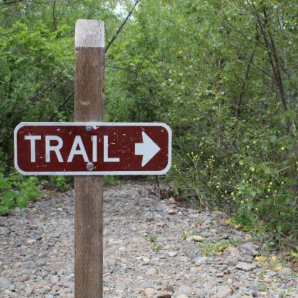
Orange County residents and visitors have a generous selection of places to get out in nature. The OC Parks system has over 20 regional parks, wilderness parks, and open space preserves. Whether you’re looking for a shady hike, a place to hit the trails on your mountain bike, or a place for horseback riding, these parks are some of the best spots in Orange County.
There is a $3 – $5 fee for parking at most of the OC Parks properties. Purchase an OC Parks Annual Pass and get unlimited parking all year.
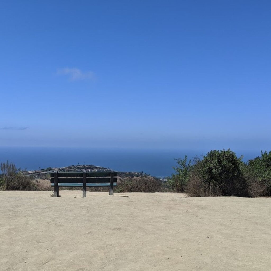
Aliso and Wood Canyons Wilderness Park
28373 Alicia Parkway, Laguna Niguel
Open 7AM to Sunset
Phone: 949-923-2200
Visitor Center Hours: M-F 9AM – 3:30PM & SA/SU 9AM – 2PM
Parking: $3
Dogs are not allowed
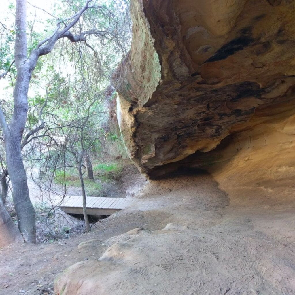
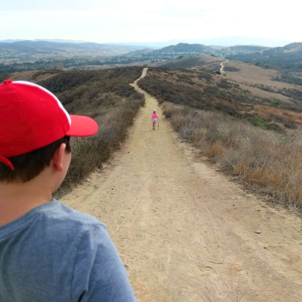
Aliso and Wood Canyons Wilderness Park in Laguna Niguel covers 4,500 acres and offers over 30 miles of trails for hiking and mountain biking. From the Awma Road parking lot, take the Aliso Creek Trail to the Wood Canyon Trail and follow the signs to Dripping Cave for an afternoon adventure. Out and back, the hike is a little over 5 miles but the trail is mostly flat so it’s relatively easy. Legends say that robbers used to hide out in the cave here after train heists.
New to mountain biking? A great beginners ride to try here clocks in at just over nine miles. From the park entrance, take Aliso Creek Trail for one and a half miles, then head up Wood Canyon Trail to the bottom of the Cholla Trail and then head back to the park entrance.
A visitor’s center offers interpretive programs and there are no playgrounds or picnic areas here. Restrooms are available here. This park is mostly used for its plentiful hiking, biking, and equestrian trails.
Aliso & Wood Canyon Wilderness Park Trail Map
Bommer Canyon
1 Bommer Canyon Road, Irvine (Trailhead)
Open 7AM to Sunset
Phone: 949-724-6835
Parking: 7AM -6PM
Dogs not permitted in Bommer Canyon
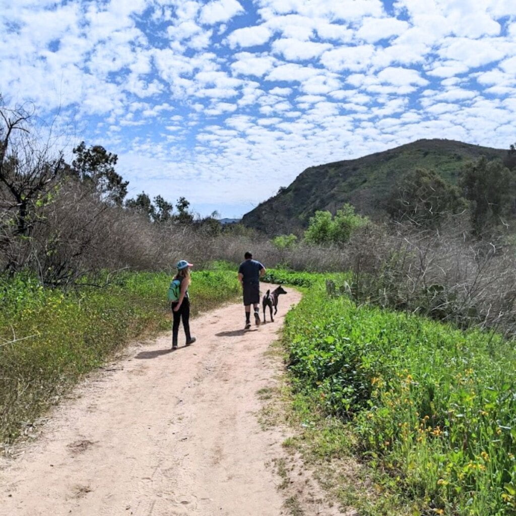
Bommer Canyon has the distinction of being part of the first California Natural Landmark; the Irvine Ranch. This preserve is 16,000 acres of wilderness open space. Much of the area is open to the public to hike, mountain bike, and reserve for special events. But some trails and areas within the canyon can only be accessed through guided programs and require pre-registration with the city or Irvine Ranch Conservancy. Here you will be led by a tour guide who can provide insight to the history of the cattle ranches and efforts to protect the sensitive ecosystems.
If you are hoping to explore on your own, here are some must do trails:
- Bommer Meadow and the Nature Loop Trail: This is an easy trail to explore and is fun to bring the kids along.
- Bommer Canyon Trail: You will find both runners and bikers on this popular almost 5-mile trail. The moderate climb takes you to the top of turtle ridge which rewards you with lovely views of the canyon. Bring water and expect to get dirty!
- Bommer Ridge and Deer Canyon Loop: This 8-mile lollipop loop is the most strenuous of the hikes listed.
Carbon Canyon Regional Park
4442 Carbon Canyon Road, Brea
Open 7AM – 9PM Spring/Summer
Open 7AM – 6PM Fall/Winter
Phone: 714-973-3160
Parking: $3-$5
Dogs are allowed on leash
Carbon Canyon Regional Park in Brea is home to one of Southern California’s few Redwood groves. A short 1.1 mile walk along a nature trail leads you to the big trees. Enjoy the walk and spend some time wandering under the canopy of 3 acres of Coastal Redwoods. This is a dirt path with some uneven terrain, but it is navigable with a jogging stroller and kids shouldn’t have any trouble with this short hike.
Carbon Canyon hosts many events for individuals and families from guided nature walks to movies in the park. Other park features include tennis and volleyball courts, ball fields, lake fishing, playgrounds, a paved path for walking or riding, a native garden, and group picnic areas. There is no nature center at this location but it’s a great spot for a short nature hike and a fun family gathering.
Car Wreck Trail – Laguna Beach
Alta Laguna Park Trailhead – 3299 Alta Laguna Blvd., Laguna Beach
Part of Aliso & Wood Canyon Wilderness Park
Restrooms available in the park
Parking at Alta Laguna Park is free
Dogs are not allowed
There’s a 1946 Dodge coupe wedged into the hillside above Laguna Beach, and the crash site was such a popular destination that the Wilderness Park made it into a trail in 2013.
The 3.8 mile loop will get your heart pumping with just under 1,000 feet of elevation gain. The best route for this hike is to start on the West Ridge Trail near the low stone wall where Top Of The World trail splits off to the left. Stay on the wide main trail as you make your way downhill and make the right onto Mathis Canyon Trail. Keep an eye out for the Car Wreck Trail signpost on the right and head downhill. You’ll head into the trees and see the wreck on your left. You can either turn around and go back, or continue past the wreck. When you see the trail sign and car door, hang a left. When you get to the end of Car Wreck Trail, make a left onto Mathis Canyon Trail and head back up the hill. Continue on the Mathis Trail until you get back to the West Ridge Trail. Hang a left and head back to where you started.
This hike has some decent hills and some rough terrain so it’s not great for younger hikers. But older kids who have hiking experience will enjoy this route. Also keep in mind that much of this trail is in full sun, so wear sunscreen and protective gear and take plenty of water. Mountain Biking is also allowed on most of the trails here so remember to look out for oncoming traffic.
Aliso & Wood Canyons Trail Map
Holy Jim
Holy Jim Trailhead | Trabuco Creek Road, Corona, CA 92883
Trail Open sunrise to sunset
Parking: Adventure Pass Required
951-736-1811
Dogs permitted on 6ft leash
Holy Jim is a popular hiking trail in Orange County in Trabuco Canyon. Yes, the trailhead address reads Corona, but it is just outside of Rancho Santa Margarita in the wilderness of Trabuco Canyon. It should be noted that this trailhead is harder to get to than most in the area. It requires a drive (about 4 to 5 miles) along a mostly dirt road. The road was closed for quite some time due to damage. Now, it is accessible, but the road can have some pretty serious dips and has a few water crossings. If there has been a lot of rain, the water levels can pretty significant over the road. Most cars can make it through here in spite of the terrain, but if you feel uncertain, always be safe and turn back. I have a Chevy Blazer and made it just fine, but I’ve heard people make it in their Prius as well.
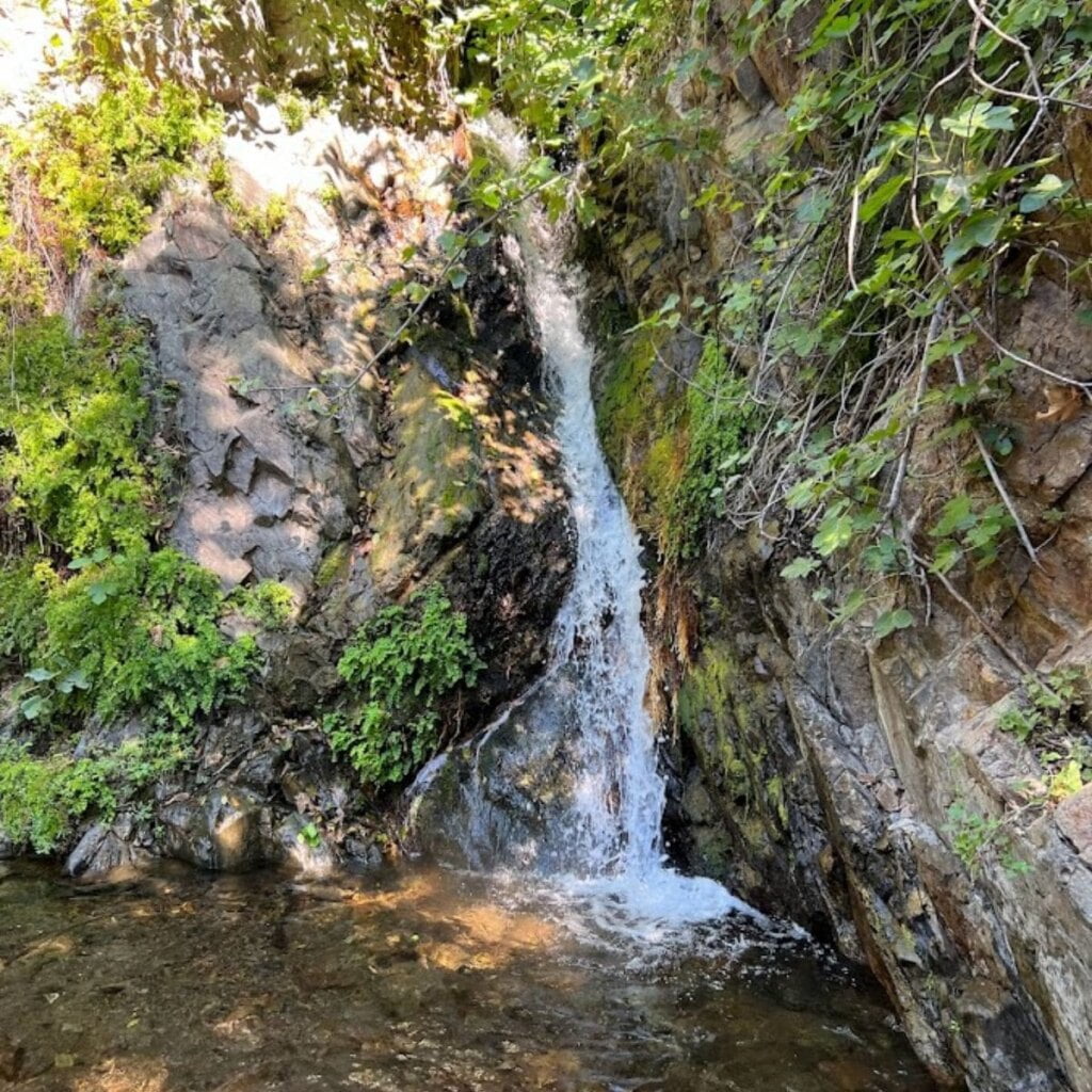
Now back to the trailhead. You’ll go about five miles, until the dirt road forks and you see a sign on the right hand side marking the Holy Jim Trailhead. Park in the dirt lot and display your Adventure Pass. From here you can take the Holy Jim Trail just above the parking lot and hike past the private cabins into Cleveland National Forest. The hike is about 4 miles round trip and relatively easy – no major uphill climbs. But there are several creek crossings, and as the hike follows the creek much of the way, beware of poison oak. Follow the signs and the trail to Holy Jim Falls and enjoy a few minutes in this peaceful spot, then turn back the way you came to return to your car. If you’d like a more strenuous hike, this is also the trailhead to get to Saddleback Mountain and Santiago Peak.
All Trails Map for Holy Jim Falls Hike
Laguna Coast Wilderness Park
18751 Laguna Canyon Road, Laguna Beach
Park Open 7AM – Sunset
Parking Lot Open 8AM-5PM
Parking is $3
949-923-2235
Dogs are not allowed
Just off the 133 in Laguna Beach, the Laguna Coast Wilderness park offers trails for hiking and mountain biking. The main lot near Nix Nature Center has several trails of varying difficulty. Some difficult trails head uphill for views of the surrounding area. Mary’s Trail is perfect for little ones with signage for an educational trip through native habitat. Follow the trail that heads away from the nature center and crosses under the 133 to pay a visit to Barbara’s Lake, one of the few naturally occurring lakes in Orange County.
For another fun hike, park at the Willow Staging Area and take the Laurel Canyon trail about a half mile to a meadow where you’ll see what locals call Ghost Face Rock. You can make this short and sweet, or you can link this trail to others in the park for a longer, more difficult hike.
There are 4 staging areas (and parking lots) along the 133 that are part of the Laguna Coast Wilderness Park: Little Sycamore Canyon Staging Area, Willow Staging Area, Dilley Staging Area, and Big Bend Staging Area. Most of the trails connect from the staging areas, but take a look at the Laguna Coast Wilderness Park trail map online before you go to see what area best suits your needs.
Oak Canyon Nature Center
6700 E Walnut Canyon Rd, Anaheim
Trails open sunrise to sunset daily
Parking is free
Parking lot gates and restrooms locked at 5PM
714-998-8380
Dogs are not allowed
Restrooms available near the parking lot
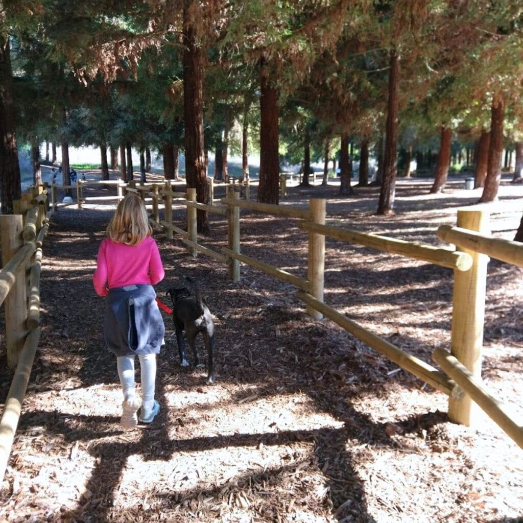
Oak Canyon Nature Center was one of our regular spots for years. There are multiple trails, some shady that meander along the side of the creek, and some rugged, in full sun at the top of the ridge. This is a perfect option for families with younger kids as the main trails are jogger-stroller-friendly, and if young walkers give up, you haven’t ventured too far no matter which direction you go.
As the kids get older, you can extend the hike, vary the terrain, and create a whole new experience. The last time we went the kids and I hit every trail in the park for multiple out and backs, and had a blast. They’re both comfortable hiking over 5 miles at a time now, but this was less, and still a worthy adventure. Mountain bikes are not allowed on the trails here.
There is a nature center here for the kids to explore before or after the hike. It is open Tuesday, Thursday, Saturday, and Sunday from 10AM to 4PM.
Oak Canyon Nature Center Trail Map
Riley Wilderness Park
30952 Oso Parkway, Coto De Caza
Open 7AM to Sunset
949-923-2265
Parking $3
Restrooms Available
Dogs are not allowed
Riley Wilderness Park is 544 acres with 5 miles of multi-use trails for hikers, mountain bikers, and equestrians. There are old groves of sycamores and Coast Live Oak, and two seasonal creeks. For breathtaking views of the park and surrounding areas, head up to Horned Toad and Skink Vista lookouts.
There is a natural butterfly garden in the park that blooms in April and May and butterfly viewing is in full swing shortly afterwards. There is a ranger station with hands on displays that showcase the rich diversity of the park’s plants and animals.
For a great family hike take Mule Deer Trail to Vista Ridge Trail where you can head up to Skink Vista Lookout. Come back down from the lookout and take Oak Canyon Trail back to the parking lot for a magical walk under the canopy of old trees. Restrooms are available and there is a $3 parking fee.
Riley Wilderness Park Trail Map
Ronald W. Caspers Wilderness Park
33401 Ortega Highway, San Juan Capistrano
Open 7AM to Sunset
Parking $3-$5
949-923-2210
Dogs are not allowed
Restrooms available
The 8,000-acre Caspers Wilderness Park in San Juan Capistrano offers miles of hiking trails, groves of Coastal Live Oak and California Sycamore, abundant wildlife, and camp sites. It’s a perfect location to get away from the busy city and spend the day, or the weekend, with family and friends.
The nature center at Caspers is full of taxidermy animals that live in the surrounding area including coyotes, squirrels, snakes, and birds. They often have coloring pages out for the kids as well as books and other hands-on activities. Rangers at Caspers offer guided nature hikes, naturalist programs, and Junior Ranger programs.
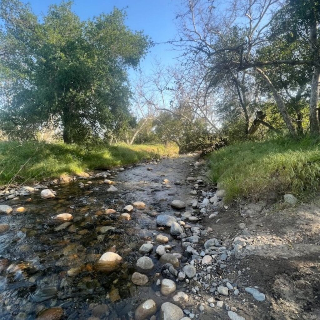
Many of the trails here are available for equestrian use and there are designated areas for equestrian camping. Enjoy an easy hike on the Bell Canyon Trail to experience the beauty and wildlife of the park. The trail is 1.85 miles long so an out and back hike clocks in at just under four miles. The trail is mostly flat the whole way and provides a combination of sun and shade.
Caspers Wilderness Park Trail Map
Santiago Oaks Regional Park
2145 N. Windes Drive, Orange, CA 92869
Open 7AM – Sunset
714-973-6620
Parking $3-$5
Dogs are allowed on leash
Restrooms available
One of our favorite places, Santiago Oaks is located in the city of Orange behind residential equestrian properties and isn’t far from neighboring Irvine Regional Park. The historic dam and creek crossing are just two of the many highlights of Santiago Oaks.
A few of the trails behind the nature center are still closed due to fire damage, but the majority of the parks trails have reopened. If you have little ones, the best route is the Santiago Creek Trail and follow the loop around Bobcat Meadow Trail. On the loop back, take the stairway down to the Historic Dam to skip rocks and look for turtles, then take the Historic Dam Trail back to the play area and restrooms.
For a more challenging hike, take the Santiago Creek Trail to the Towhee Trail and follow it up the the Wilderness Trail. Use the Oak Trail to connect to the Sage Ridge Trail until you connect to Bobcat Meadow. Take Bobcat Meadow back to Santiago Creek and the Historic Dam. In addition to these easy to moderate trails, Santiago Oaks has a number of difficult trails that head into the backcountry so hikers of all skill levels can find an adventure here. See the Santiago Oaks trail map for trail lengths and ratings.
Whiting Ranch Wilderness Park
Two Entry Points – Borrego Parking Lot: 26701 Portola Parkway, Foothill Ranch OR 27901 Glenn Ranch Road, Trabuco Canyon
Open 7AM to Sunset
Parking $3
Restrooms at the trailhead
Dogs are not allowed
Whiting Ranch is a popular spot for mountain biking. There are 17 miles of trails here, with Red Rock Canyon and Billy Goat Trails reserved for hikers only. All other trails are open for hikers, bikers, and equestrians. There are no picnic or play areas here and the only restroom is a port-a-potty. This park is for trail adventures only.
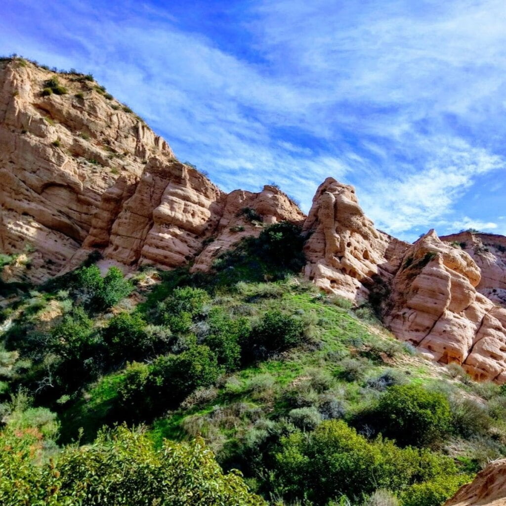
Whiting Ranch is by far one of the best hiking spots in OC, as it is home to Red Rock Canyon, a beautiful location with magnificent rock formations. For the easiest access to Red Rock Canyon, enter from the Borrego parking lot. The Borrego Canyon Trail ascends gently towards Red Rock Canyon making the first portion of the journey relatively easy. The Red Rock Canyon Trail has a lot of rocky terrain and dry stream beds to navigate so this portion is more difficult, but worth the effort for the view. Round trip, the hike is about 5 miles. See the Whiting Ranch Trail Map for details. The shopping center next to the Borrego parking lot has a grocery store and several spots to fuel up afterwards.
For more information and trail maps for these and other parks in Orange County, visit the OC Parks website.
More Orange County Trails
Anaheim:
- Anaheim Wetlands: Connection to 14.6 miles of trails of varying difficulty
- Deer Canyon Park Preserve: Numerous trails; Natural
- East Hills Trail: 1.5 miles; Natural
- Featherly Regional Park
- Gypsum Canyon Wilderness
- Oak Canyon Nature Center
- Weir Canyon: 3.8 mile loop; Rated moderate. Natural
- Yorba Regional Park:
Brea:
- Olinda Oil Museum & Trail: 1.9 miles; Rated easy. Natural
Buena Park:
- Trail Head to H2O Tower: 3841-4097 Rosecrans Ave.
- Hawks Pointe Trail: 4097 Rosecrans Ave.
- Clark Regional Park: Paved and natural trails
Costa Mesa:
- Fairview Park: 2525 Placentia Ave., numerous trails
- Talbert Regional Park: 1298 Victoria Ave.
- Canyon Park: 970 Arbor Street
Dana Point:
- Dana Point Bluff Top Trail: 34342 Street of the Amber Lantern
- Headlands Conservation Area Trail System
- Dana Point Seasonal Waterfall: 24413-24469 Dana Point Harbor Dr; Short trail to an occasional waterfall
Fullerton:
- Fullerton Loop
- Nora Kuttner Recreational Trail: Castlewood drive
- Hiltscher Park: 1002 N Euclid Street
- Juanita Cooke Trail
- Panorama Nature Preserve: 1903 St Simons Place
- West Coyote Hills Tree Park: 2349 N Parks Road
- Robert E. Ward Nature Preserve: 2245 N Euclid Street
Huntington Beach:
- Bolsa Chica Wetlands: 18000 CA-1
- Shipley Nature Center: 17851 Goldenwest St
- Urban Forest: 6681 Ellis Avenue
Irvine:
- Hicks Haul Road
- Orchard Hills Loop
- Quail Hill
- Turtle Rock Nature Center
- Irvine Open Space Preserve Trails
Laguna Beach:
- Laguna Beach Cliff Hike: 22141 Paseo Del Sur
- Crystal Cove State Park Trails: All levels of difficulty
- Canyon Acres Trailhead: 582-580 Canyon Acres Dr; Rated difficult
Laguna Niguel:
- Aliso Summit Trail: 2.83 miles; Rated moderate. Mostly decomposed granite sidewalk
- Colinas Bluff Trail: 4.73 miles; Rated difficult. Mostly natural with portions of asphalt, concrete, decomposed granite
- Laguna Ridge: 2.56 miles; Rated very easy. Sidewalk and decomposed granite
- Long View Park Trail: 1.35 miles; Rated moderate. Natural, pavement, sidewalk
- Niguel Trail: 4.86 miles; Rated easy. Sidewalk, decomposed granite, concrete, asphalt
- Oso Creek: 1.58 miles; Rated very easy. Asphalt, decomposed granite
- Salt Creek Trail: 5.7 miles; Rated difficult. Mix of natural, asphalt, sidewalk, decomposed granite
Lake Forest:
Mission Viejo:
- Oso Creek Trail: 24932 Veterans Way, Mission Viejo
- Arroyo Trabuco Trail
- Wilderness Glen
- Wandering Trails Park
Newport Beach:
- Pacific Ridge Trailhead
- Upper Newport Bay Nature Preserve: 2301 University Dr
- Buck Gully Reserve
Orange:
San Clemente:
- Ridgeline Trail-Camino Del Rio
- Rancho San Clemente Trail
- Sea Summit Trail – North El Camino Real Trailhead
- Pico Park Sea Summit Trailhead
- Knob Hill
- Roller Coaster Ridge
- Trestles Beach Trailhead
- Vista Del Sol Park
- San Onofre Bluffs Trail
San Juan Capistrano:
- Las Ramblas Trailhead
- Patriot Trail
Silverado:
- Black Star Canyon
- Maple Springs Trailhead
- Harding Truck Trail
- Limestone Canyon
- Falls Canyon Trailhead (currently closed?)
- Four Corners/Cactus Hill Trail
- Baker Canyon Staging Area
- Modjeska Canyon
- Four Marines Aviation Memorial – Bell View Trail to Small Peak
- O’Neill Regional Park Trails
Tustin:
Yorba Linda:
Yorba Linda has an ambitious Citywide system of over 100 miles of trails coordinated for use by hikers, bikers, and equestrians. Print and view the Yorba Linda Trails Map (PDF).