Find Orange County maps and resources to even more maps of Orange County including printable and pdf maps. OC maps include by city, boundaries, political districts, aerial, historical, fire hazard areas and much more.
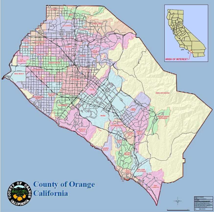
Map of Orange County
Printable Map of Orange County CA pdf
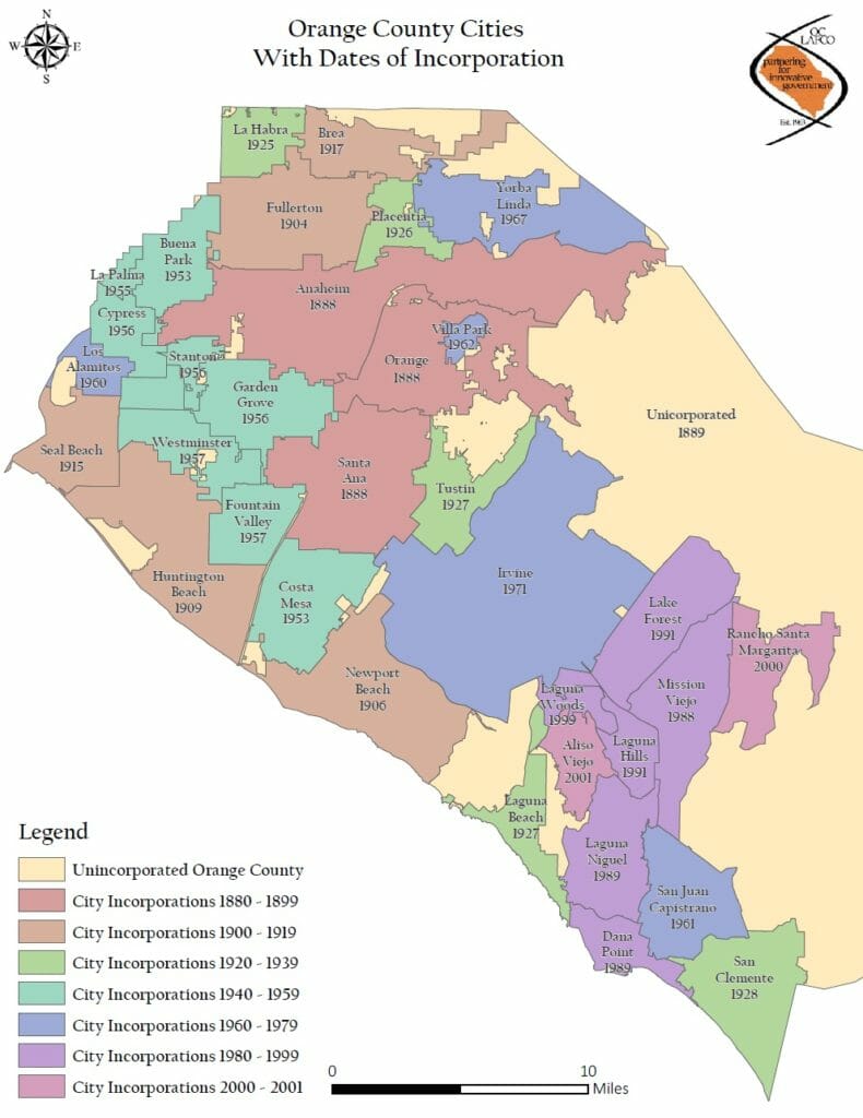
Orange County Cities Map with Dates of Incorporation
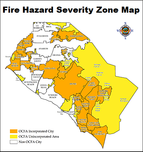
Orange County Fire Hazard Maps
Fire Hazard Severity Zone (FHSZ) maps are created by the California Department of Forestry and Fire Protection (Cal Fire) to identify areas where a wildfire is more likely to occur.
Orange County FHSZ Map
State Responsibility Area (SRA):
California Fire Hazard Severity Zone Viewer
Orange County FHSZ Maps by City
Orange Count Fire Authority (OCFA) Service Areas (PDF)
Natural Disasters Maps
- Orange County Flood Maps – Orange County drainage system maps
- Fault Activity Map of California
- FEMA Flood Map Service Center – Use the official flood map tool to better understanding flood risk for an address, place or longitude/latitude
- Fire Perimeters & Deep Landslide Susceptibility Map
- Historic Earthquake Map
- Reported California Landslides Map
- Tsunami Inundation Maps
Orange County Tourism Maps
More Orange County Map Resources
- Orange County Election Map – Boundaries by City, Supervisor, Assembly, Senate and Congress.
- Orange County Facilities Map
- Orange County GIS – Find printable paper and pdf maps including political districts, city boundaries, parcel polygons, census maps and more.
- Orange County Parks Map
- Orange County Rocks and Islands – Managed by the Bureau of Land Management.
- Orange County School District Map – District boundaries for the 27 school districts in Orange County.
- Orange County Tax Map – Orange county parcel data from the Orange County Office of the Assessor. Includes parcel boundaries, property information, roll values, legal descriptions. Zoom in close to a area to activate the layer.
- Orange County Unincorporated Map – Map of the 24 unincorporated islands located in or adjacent to 18 different cities in Orange County.
- Orange County Zip Code Boundary Map – Map overlay of zip codes and cities.
- Caltrans District Twelve Map (Orange County)
- CSUF Center for Demographic Research (CDR) – The (CDR) provides a wide range of demographic and GIS/Mapping services focused on the Orange County area including custom mapping, geocoding, GIS analysis and high quality maps and images.
- OCPW Maps – Land records. Layers include parcels, subdivisions, and zoning.
Orange County Traffic & Transportation Maps
- Orange County Annual Traffic Volume Maps – Average daily traffic counts on arterial roadways are collected from each of the 34 cities and the county on an annual basis to create the Traffic Flow Map.
- OCTA Bus System Maps – OCTA’s bus system offers 62 different routes and nearly 5,200 bus stop.
- Metrolink System Map – OCTA’s Metrolink rail service has 11 stations from Buena Park to San Clemente.
Orange County Historical Maps
- Calisphere – Provides free access to unique and historically important artifacts for research, teaching, and curious exploration including many old maps of Orange County.
- Library of Congress – Another resource for old Orange County maps.
- Orange County Historical Aerial Imagery – View comprehensive current and historical aerial maps and satellite imagery of Orange county, California are available from Aerial Archives including high resolution digital files, large murals, prints and other imagery.
- City of Orange Digital Collection
Vintage road or travel maps are another great resource for historical maps e.g. Thomas Guides, AAA Travel Road Maps or even gas station road maps that were produced by Chevron and Shell. Many of these can be found on eBay, Amazon, Etsy and other online marketplaces.
Related Articles


